Measurement campaigns
We are a member of the Airborne Research Facility for the Earth System (ARES), which is a joint research infrastructure for measuring terrestrial processes of the Earth system at a regional level led by the University of Zurich. Empa leads the atmospheric remote sensing activities in ARES, particularly monitoring of greenhouse gas emissions.

AVIRIS-4 methane campaigns
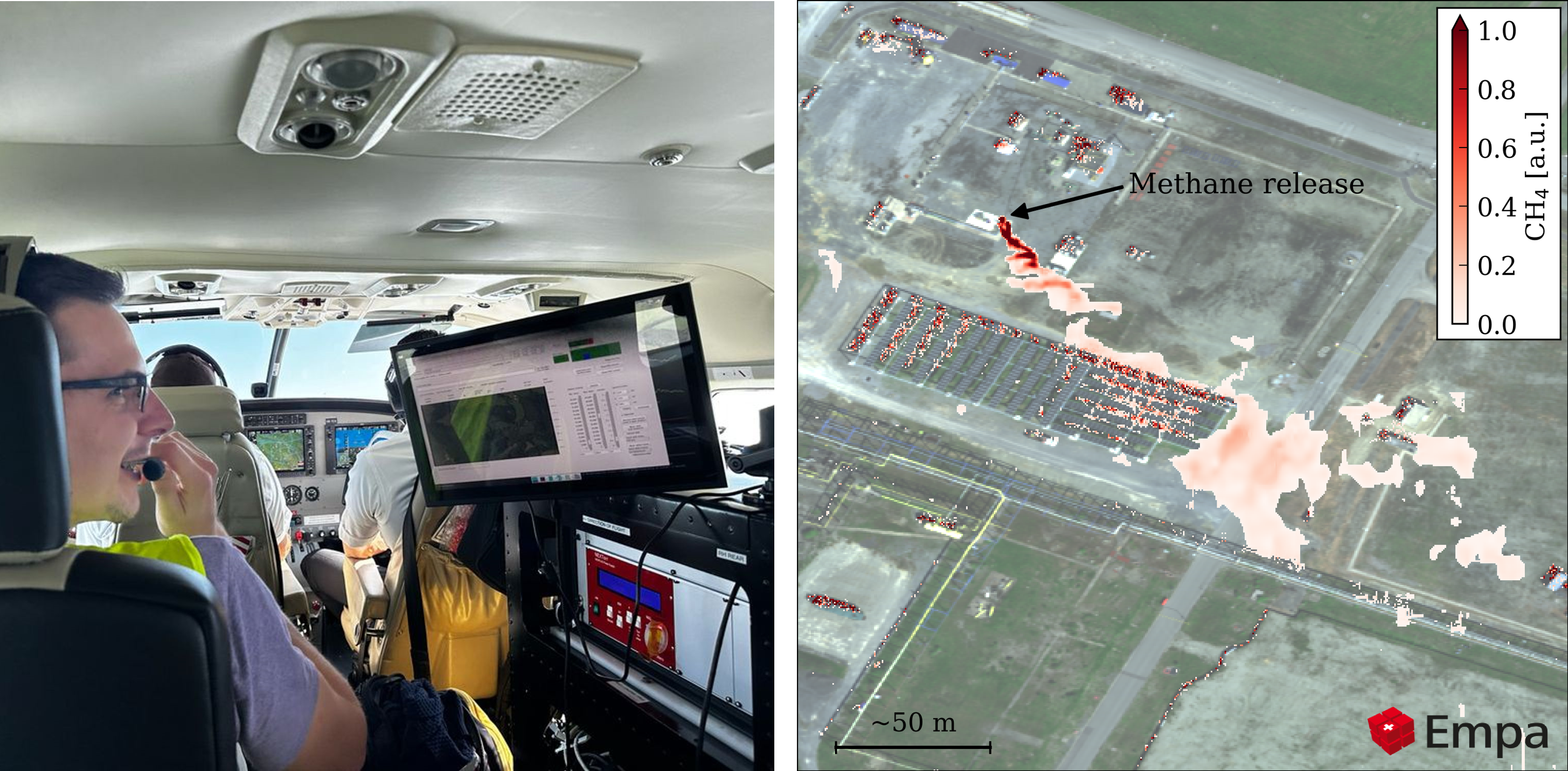
The central measuring instrument of ARES is the AVIRIS-4 imaging spectrometer, which was developed by NASA/JPL and taken over by the University of Zurich in 2022. AVIRIS-4 is the successor to the AVIRIS-NG instrument - with higher precision and improved spatial resolution.
We use AVIRIS-4 for detecting and quantifying methane emissions from anthropogenic sources such as the oil and gas sector, landsfills and coal mining. First methane plumes were succesful imaged during a release experiment in September 2024 in a release experiment near Pau in France.
AVIRIS-NG Romania campaign 2021
In 2021, we conducted a targeted measurement campaign in Romania using the AVIRIS-NG imaging spectrometer to detect and quantify methane emissions from the oil and gas sector. This initiative followed a 2019 campaign that revealed methane emissions in the region were significantly underreported.
The 2021 follow-up campaign employed advanced airborne remote sensing techniques and revealed a substantial reduction in methane emissions - ranging from 20% to 60% - attributed to improvements in infrastructure and mitigation practices.
This study underscores the critical role of measurement-based emissions monitoring and demonstrates the value of a multi-scale approach that integrates ground-based observations with large-scale airborne remote sensing. Our findings highlight the importance of continued surveillance and technological investment to ensure transparency and accountability in greenhouse gas reporting.
Munich NO2 Imaging Campaign 2016
The Munich NO₂ Imaging Campaign (MuNIC) was a comprehensive study conducted in July 2016 in Munich, Germany, aimed at mapping the spatial distribution of nitrogen dioxide (NO₂) using a combination of in situ and remote sensing instruments. The campaign involved stationary, mobile, and airborne measurements to capture both near-surface concentrations (NSCs) and vertical column densities (VCDs) of NO₂.

- Kuhlmann et al.: Evidence of successful methane mitigation in one of Europe's most important oil production region, Atmos. Chem. Phys., https://doi.org/10.5194/acp-25-5371-2025, 2025.
- Kuhlmann et al.: Mapping the spatial distribution of NO2 with in situ and remote sensing instruments during the Munich NO2 imaging campaign, Atmos. Meas. Tech., https://doi.org/10.5194/amt-15-1609-2022, 2022.
- Zhu et al.: Spatial and temporal representativeness of point measurements for nitrogen dioxide pollution levels in cities, Atmos. Chem. Phys., https://doi.org/10.5194/acp-20-13241-2020, 2020.


